
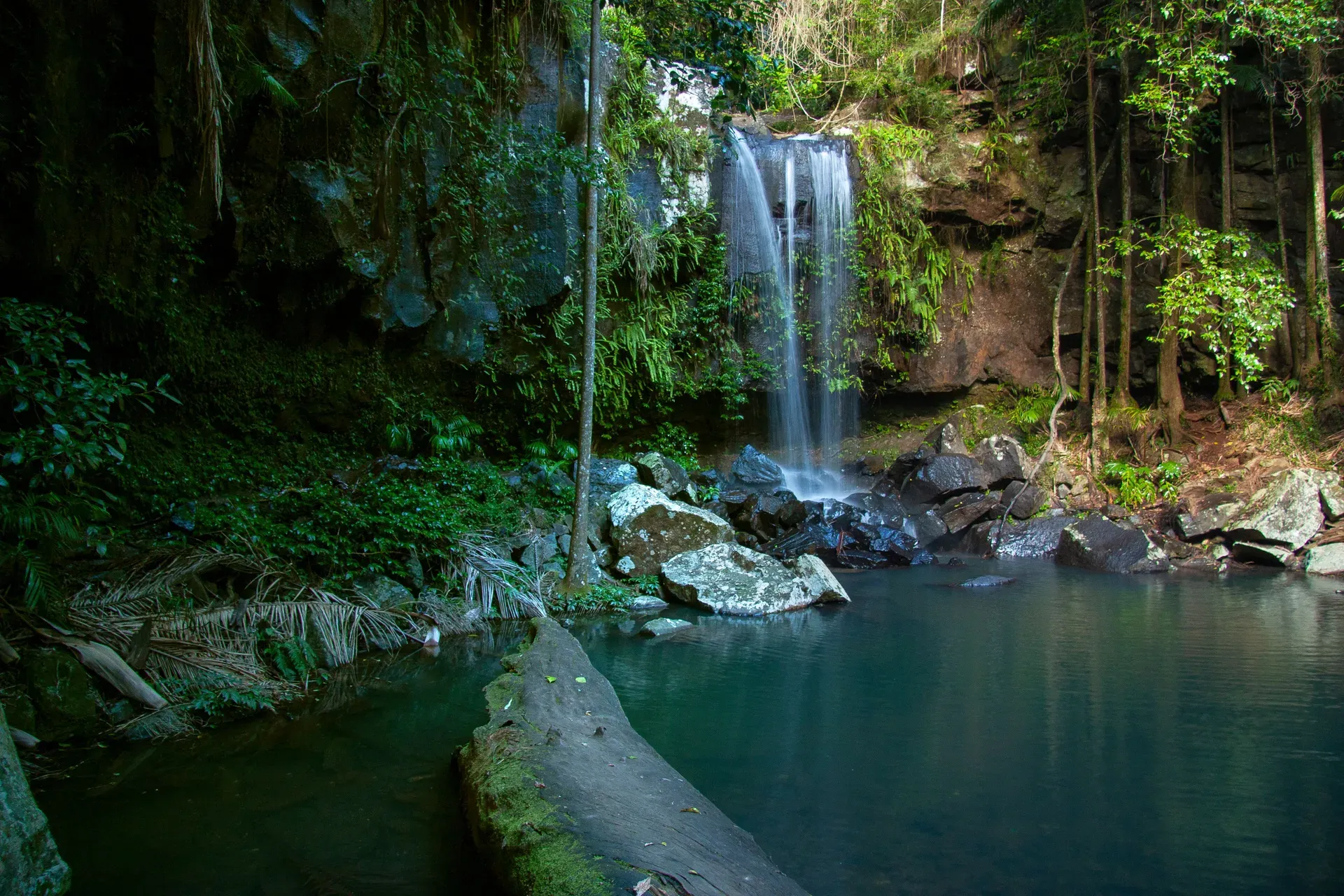
Four named waterfalls are worth planning a walk around on Tamborine Mountain: Curtis Falls, Cedar Creek Falls, Cameron Falls and Witches Falls. A fifth, Jenyns Falls, still shows up on old maps and blog posts, but its lookout has been closed for years. Curtis Falls runs on a permanent spring and flows even in a dry August. Cedar Creek is the only place on the whole plateau where swimming is actually allowed. Cameron and Witches only put on a show after real rain. Together they cover a decent cross-section of what the mountain does best: dense rainforest, basalt gorges and a bit of history baked into the rock.
All four sit inside Tamborine National Park, a scatter of 14 separate reserves across a basalt plateau that rose from lava flows roughly 23 million years ago, fed by the ancient Tweed Volcano centred on Wollumbin (Mount Warning) to the south. That volcanic rock is why the creeks here drop suddenly over dark, columned cliffs instead of sloping gently downhill. This guide runs through official distances, walk times and difficulty grades for every track, plus what to actually expect when you reach the water.
Mount Tamborine's Waterfalls at a Glance
Five names circulate when people search for Mount Tamborine waterfalls, but only four have a working lookout. Here's how the walks stack up, using Queensland Parks and Wildlife Service's official trail data rather than personal impressions.
| Waterfall | Distance & Time | Grade | Swimming | Accessibility |
|---|---|---|---|---|
| Curtis Falls | 1.1km return, ~30 min | Grade 3 | No — restricted area | Steps and uneven ground, not wheelchair suitable |
| Cedar Creek Falls | 500m return lookout (~15 min) or 1.1km to pools (~30 min) | Grade 1 / Grade 3 | Yes — rock pools only | Lookout track suitable for assisted wheelchair access |
| Cameron Falls | 2.6km circuit, ~1 hr | Grade 4 | No | Not wheelchair accessible, steep sections |
| Witches Falls | 3.6km return, ~1 hr | Grade 4 | No | Not wheelchair accessible, steep descent |
| Jenyns Falls | Lookout closed permanently; 4.8km circuit, ~1.5 hr (no falls view) | Grade 4 | No | Not accessible |
Curtis Falls is the pick if you've only got time for one walk — short, shaded and running with water no matter the season. Cedar Creek is the one to bring swimwear for. Cameron and Witches are rain-fed, so plan around the weather: the wettest months, December to April, dump about 1,500mm of rain on the plateau and get both falls running properly, while winter (June to August) brings mild, dry days around 17°C that suit walking but leave the seasonal falls thin. Only Cedar Creek's lookout track is graded for assisted wheelchair access; the rest involve steps, tree roots or loose rock, so plan accordingly if mobility is a factor.
Curtis Falls: The Mountain's Most Famous Waterfall
Curtis Falls, in the park's Joalah section off Dapsang Drive and Eagle Heights Road, is the walk most visitors do first. The track runs 1.1km return, Grade 3, about 30 minutes, dropping through rainforest to a viewing platform above a rock pool ringed by exposed basalt. Cedar Creek feeds it from a permanent spring, so unlike most of the mountain's falls, Curtis keeps flowing through the dry season. Basalt columns rise on either side of the pool, laid down when lava from the ancient Tweed Volcano cooled and cracked into hexagonal sections, a texture you'll notice throughout the gorge.
You can't get into the water here, at any time. QPWS keeps the pool off-limits to protect a resident population of glow-worms and platypus, and penalties apply for entering the restricted area. It's an easy rule to want to break on a hot afternoon, with clear water sitting still just below the platform, but this is the one worth actually respecting. If glow-worms are the draw, see them properly after dark on a guided cave tour instead, where a red torch and a real guide are part of the deal.
Want a longer walk from the same car park? The Lower Creek Circuit branches off partway down, adding 2.5km return, Grade 4, about an hour, with several creek crossings you rock-hop rather than bridge. Watch the leaf litter for brush-turkeys scratching through it, and look into the pool for turtles and eels — the platypus are shy and mostly active around dawn and dusk. Expect a steady stream of foot traffic here on weekends, since this is the most walked track on the mountain.
Cedar Creek Falls & Rock Pools: Where You Can Actually Swim
Cedar Creek has two tracks leaving the same car park on Cedar Creek Falls Road, and they suit different visitors. The lookout walk is a flat 500m return, Grade 1, about 15 minutes, graded suitable for assisted wheelchair access — the easiest waterfall view on the mountain. A second track continues 1.1km return, Grade 3, about 30 minutes, down steps and uneven ground to the rock pools themselves. Tree ferns crowd the descent, and the temperature drops noticeably as you get closer to the water.
This is the only spot on Tamborine Mountain where swimming is actually allowed, and it gets busy for exactly that reason. The pools aren't patrolled, so you're in at your own risk — QPWS has recorded serious injuries and deaths here from slippery rocks and water levels that change fast. No diving, no jumping off the rocks, and leave the glass at home: glass containers are banned in the gorge and rock pool area, with penalties for anyone caught carrying one in.
Tamborine Mountain has no reticulated town water supply, which is the practical reason Cedar Creek's pools are the only sanctioned swimming holes on the whole plateau. That makes the car park a genuine bottleneck — it's small, and it fills by mid-morning on weekends and public holidays. Police issue infringement notices for cars parked illegally along Cedar Creek Falls Road, so get there before 9am or come on a weekday. Check the gate hours for the Cedar Creek section before you drive up, too — it's locked overnight and the closing time shifts with the season. Arrive on a weekday morning and you might have the pools to yourself.
Cameron Falls: Valley Views from the Knoll
Cameron Falls sits in The Knoll section, reached via the Sandy Creek circuit from the Knoll Road car park — 2.6km, Grade 4, about an hour, with a short 100m branch out to the falls lookout. It's a proper bush walk rather than a stroll, with a real climb on the way back to the car. The track climbs through open eucalypt forest before dropping into rainforest, a transition that's easy to miss if you're not watching the canopy change overhead.
Keep your expectations realistic on the falls themselves. They're rain-fed rather than spring-fed, so in a dry stretch you'll find a damp, mossy rock face instead of a waterfall, and even after rain, trees partly block the direct view. The consolation is better than the falls: the lookout opens onto valley views out to Flinders Peak and, on a clear day, all the way to Brisbane. Time your visit within a day or two of solid rain if the waterfall is really the goal, and keep an eye on the exposed rocks nearby — black skinks like to sun themselves there.
Witches Falls: Queensland's Oldest National Park
Witches Falls carries more history than water most of the year. This stretch of rainforest was declared Queensland's first national park in 1908, under the State Forests and National Parks Act 1906. Every other section of Tamborine National Park was added later, some not until decades afterward. The circuit starts at the Main Western Road car park and runs 3.6km return, Grade 4, about an hour, dropping through closed forest to a 200m detour lookout over the falls.
Like Cameron, it's rain-dependent — go after a decent downpour or you'll be looking at bare rock. The descent passes cycad groves, seasonal lagoons and strangler figs thick enough to hide the trees they started on, and it's one of the better spots on the mountain to hear an Albert's lyrebird calling in winter. Richmond birdwing butterflies pass through the same rainforest in spring. Walkers wanting more distance can peel off onto Witches Chase, a 2.6km return, Grade 4 branch track that adds roughly another hour without circling back past the falls. Budget half a day if you're doing both.
Jenyns Falls: Why It's No Longer on the Map
Skip it. The Jenyns Falls lookout has been closed for safety reasons, permanently, and Queensland Parks has no plan to reopen it.
The 4.8km Jenyns circuit, Grade 4, about 1 hour 30 minutes, running through the Palm Grove section, is still open and still a decent rainforest walk — piccabeen palms, strangler figs, the same brush-turkeys and skinks you'll see elsewhere on the mountain — but it no longer passes a viewpoint over the falls. It still gives a good sense of the mountain's rainforest without the crowds that gather at Curtis Falls or Cedar Creek. Go for the walk, not the waterfall, and put your time into Curtis or Cedar Creek instead.
Planning Your Waterfall Visit
Tamborine Mountain is about 80km south of Brisbane, roughly 1h15 by car via Beenleigh and Tamborine Village, and about 36km from Southport on the Gold Coast, around 50 minutes via the Pacific Highway and Oxenford-Tamborine Road. The roads up from Nerang and Canungra are steep and narrow, fine for a car but unsuitable for buses or caravans. Without a car, the only public transport route is a bus to Nerang followed by a taxi, so most visitors either self-drive or book a tour. Check full directions and route options before you drive up, especially from Brisbane, where there's more than one way in.
- Dogs and other pets aren't permitted anywhere in Tamborine National Park.
- Camping isn't allowed in the park; stay in mountain accommodation instead.
- No rubbish bins are provided at any picnic or day-use area — carry everything out.
- Wear sturdy, closed shoes; tracks get slippery, especially after rain, and thongs won't cut it.
Cedar Creek and Witches Falls are the only two sections with facilities. Cedar Creek has a picnic shelter and gas barbecue with assisted wheelchair access; Witches Falls adds electric barbecues, wheelchair-accessible tables and toilets. Curtis Falls and Cameron Falls have neither, so use the toilet before you set off. Bring insect repellent too — the humidity after rain brings out mosquitoes and leeches on the shadier tracks like Witches Falls and the Lower Creek Circuit.
Two or three of these walks fit into a single half-day. A workable loop: Curtis Falls in the morning, lunch in North Tamborine, then the Cedar Creek lookout (or the rock pools, weather permitting) in the afternoon. Families with young kids should stick to Curtis Falls and the Cedar Creek lookout, both short and shaded; keen walkers can add Witches Falls or the Lower Creek Circuit for a fuller day on their feet. If you'd rather not do the driving and route-planning yourself, day trips from the Gold Coast and from Brisbane often combine a waterfall walk with the Rainforest Skywalk or a stop at a mountain winery. For something after dark, pair a daytime falls walk with an evening glow-worm cave tour — a legal way to see the bioluminescent larvae that Curtis Falls' pool is closed off to protect. Skip camping altogether and book a night on the mountain instead; our accommodation guide covers the options.
Frequently asked questions
How many waterfalls are there on Mount Tamborine?
Four are worth the walk: Curtis Falls, Cedar Creek Falls, Cameron Falls and Witches Falls. A fifth, Jenyns Falls, still shows up on old maps and blog lists, but its viewing lookout has been permanently closed for safety, so it's not part of a realistic itinerary anymore.
Which Mount Tamborine waterfall can you swim in?
Only Cedar Creek Falls. Its rock pools are the sole legal swimming spot on the whole mountain, since Tamborine Mountain has no reticulated town water supply. Swimming is banned at Curtis Falls to protect resident glow-worm and platypus populations, and penalties apply for entering the restricted pool area there.
What is the best time to visit Mount Tamborine waterfalls?
Aim for a day or two after solid rain, especially during the wet season from December to April, if you want to see Cameron or Witches Falls actually running. Curtis Falls is fed by a permanent spring and flows year-round regardless of recent weather, so it's the safe bet in a dry spell.
How long is the walk to Curtis Falls?
1.1km return, Grade 3, about 30 minutes each way, starting from the car park off Dapsang Drive or Eagle Heights Road. It's one of the more heavily used tracks on the mountain, so expect company on weekends.
Are dogs allowed on the Mount Tamborine waterfall walks?
No. Dogs and other domestic pets aren't permitted anywhere inside Tamborine National Park, on any of the waterfall tracks or picnic areas, with the sole exception of horses on a few designated forest trails.
Is Jenyns Falls still worth visiting?
Not for the waterfall itself. The viewing lookout has been closed permanently for safety with no plan to reopen, though the 4.8km Jenyns circuit through the Palm Grove section is still open as a rainforest walk without a falls view.
How far is Mount Tamborine from Brisbane and the Gold Coast?
About 80km and roughly 1h15 by car from Brisbane, via Beenleigh and Tamborine Village. From the Gold Coast, it's about 36km and around 50 minutes from Southport via the Pacific Highway and Oxenford-Tamborine Road.
Can you camp near the waterfalls?
No. Camping isn't permitted anywhere inside Tamborine National Park to protect its natural values. Visitors stay at private accommodation, cottages or campgrounds elsewhere on the mountain instead.